INFRARED AND RTK DRONES

Photo jun 21 2023  1 01 50 am

Infrared & RTK Drone Technology for Construction Sites in Boise, ID

──
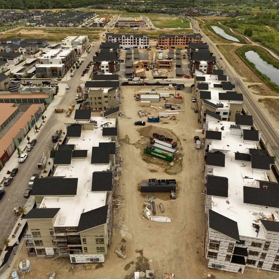
High-accuracy aerial data. Thermal insight without stepping on site.
If you’re still walking roofs or waiting days for site progress reports, there’s a faster, safer, and more precise way to see what’s happening. Boise Aerial Drone Photography deploys RTK-equipped Mavic 3 Enterprise drones (3E & 3T) to give you the exact data you need, without tying up your crew or blowing the budget.
Schedule Your Consultation Today


RTK Positioning Gets the Whole Picture—Down to the Centimeter

──

RTK (Real-Time Kinematic) positioning delivers pinpoint accuracy that traditional GPS just can’t match. That means tight tolerances, fewer site visits, and maps you can actually rely on for grading, concrete prep, and inspections.

What it means for your job site:
  • Centimeter-level accuracy for site mapping, layout, and documentation
     
  • Mechanical shutter for sharp, distortion-free images
     
  • Precise 2D orthomosaics and 3D models often eliminate the need for a third-party survey team
     
  • Fast turnaround, with imagery and maps delivered same- or next-day
     
You don’t need to know the difference between GNSS and PPK. You just need the data to be right and ready when you are.
.

Drone Thermal Imaging Captures What Others Miss

──
Thermal imaging isn’t just a flashy add-on—it’s a practical tool that gives you critical insight without tearing into drywall or climbing onto a roof. With the Mavic 3T’s integrated infrared camera, you can detect hotspots in electrical or mechanical systems, identify water intrusion behind walls or under roofing, and monitor safety risks from a safe distance. It’s also a fast, non-invasive way to verify insulation coverage and material placement without slowing down the schedule or opening up finished work.
.

Tight Integration with Industry Software (DroneDeploy)

──
All data is processed and delivered through DroneDeploy, the leading platform for construction-focused drone work.

You get:
  • Real-time progress maps and timeline views
  • Annotated reports for site coordination and issue tracking
  • 360° walkthroughs and visual documentation for compliance or client updates
  • Easy exports to CAD, GIS, or BIM software
     
No special training required. If you can open a web browser, you can use the data.
.

Why Work With Boise Aerial Drone Photography?

──
We’re not just drone hobbyists. We’re a production-grade crew with 95+ years of combined experience, working with top-tier companies on job sites that don’t have time for do-overs.
 

Who trusts us: 

  • Disney
  • NBA
  • Simplot
  • Top Golf
  • Suntec
  • W&W Steel Co.
     
All flights are FAA Part 107 compliant, with safety protocols tailored to live construction environments.
.

The Bottom Line

Infrared and RTK drone technology lets you see more, know more, and fix more, before it costs you time or money. By giving you a clearer, more accurate view of your job site, we help you catch problems early, track progress with confidence, keep stakeholders in the loop, and make informed decisions based on real data, not just best guesses.
 

Ready to Fly?

Boise Aerial Drone Photography customizes the service to your job site, your schedule, and your budget—and we’ll beat any competitor’s rate. Whether you need thermal inspections, survey-grade maps, or full documentation of your build, we’re ready when you are.
 
Serving general contractors, project managers, and owners in Boise, the Treasure Valley, and across the region.
Request a quote online or by calling (208) 912-2963 today. 

Contact Josh Today

Send  a message using the form below.
 

🇺🇸 VETERAN OWNED BUSINESS 🇺🇸